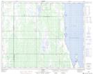
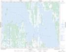
Maps showing Crane River, 29-13-W, Manitoba
Crane River is a River located in 29-13-W, Manitoba.
- Latitude: 51° 31' 26'' North (decimal: 51.5238999)
- Longitude: 99° 15' 56'' West (decimal: -99.2656000)
- Topography Feature Category: River
- Geographical Feature: River
- Canadian Province/Territory: Manitoba
- Location: 29-13-W
- Atlas of Canada Locator Map: Crane River
- GPS Coordinate Locator Map: Crane River Lat/Long
Crane River NTS Map Sheets