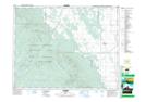
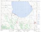
Maps showing Crawford Creek, 15-24-17-W, Manitoba
Crawford Creek is a River located in 15-24-17-W, Manitoba and has an elevation of 326 meters.
- Latitude: 51° 4' 52'' North (decimal: 51.0811000)
- Longitude: 99° 46' 40'' West (decimal: -99.7777999)
- Topography Feature Category: River
- Geographical Feature: Creek
- Canadian Province/Territory: Manitoba
- Elevation: 326 meters
- Location: 15-24-17-W
- Atlas of Canada Locator Map: Crawford Creek
- GPS Coordinate Locator Map: Crawford Creek Lat/Long
Crawford Creek NTS Map Sheets