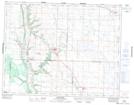
Maps showing Crescent Ridge Hill, 29,30-19-28-W, Manitoba
Crescent Ridge Hill is a Mountain located in 29,30-19-28-W, Manitoba and has an elevation of 527 meters.
- Latitude: 50° 39' 42'' North (decimal: 50.6616999)
- Longitude: 101° 20' 46'' West (decimal: -101.3460999)
- Topography Feature Category: Mountain
- Geographical Feature: Hill
- Canadian Province/Territory: Manitoba
- Elevation: 527 meters
- Location: 29,30-19-28-W
- Atlas of Canada Locator Map: Crescent Ridge Hill
- GPS Coordinate Locator Map: Crescent Ridge Hill Lat/Long
Crescent Ridge Hill NTS Map Sheets