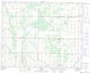
Maps showing Crocus Hill, 17-27-21-W, Manitoba
Crocus Hill is a Mountain located in 17-27-21-W, Manitoba and has an elevation of 340 meters.
- Latitude: 51° 18' 47'' North (decimal: 51.3131000)
- Longitude: 100° 22' 37'' West (decimal: -100.3769000)
- Topography Feature Category: Mountain
- Geographical Feature: Hill
- Canadian Province/Territory: Manitoba
- Elevation: 340 meters
- Location: 17-27-21-W
- Atlas of Canada Locator Map: Crocus Hill
- GPS Coordinate Locator Map: Crocus Hill Lat/Long
Crocus Hill NTS Map Sheets