Maps showing Crowduck Falls, 27-14-17-E, Manitoba
Crowduck Falls is a Falls located in 27-14-17-E, Manitoba and has an elevation of 317 meters.
- Latitude: 50° 11' 54'' North (decimal: 50.1983000)
- Longitude: 95° 11' 33'' West (decimal: -95.1925000)
- Topography Feature Category: Falls
- Geographical Feature: Falls
- Canadian Province/Territory: Manitoba
- Elevation: 317 meters
- Location: 27-14-17-E
- Atlas of Canada Locator Map: Crowduck Falls
- GPS Coordinate Locator Map: Crowduck Falls Lat/Long
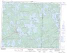
Crowduck Falls NTS Map Sheets