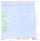
Maps showing Cummings Reef, Manitoba
Cummings Reef is a Shoal located in Manitoba and has an elevation of 222 meters.
- Latitude: 52° 17' 8'' North (decimal: 52.2856000)
- Longitude: 97° 58' 33'' West (decimal: -97.9758000)
- Topography Feature Category: Shoal
- Geographical Feature: Reef
- Canadian Province/Territory: Manitoba
- Elevation: 222 meters
- Atlas of Canada Locator Map: Cummings Reef
- GPS Coordinate Locator Map: Cummings Reef Lat/Long
Cummings Reef NTS Map Sheets