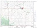
Maps showing Cumpstone Lake, 7-1-18-W, Manitoba
Cumpstone Lake is a Lake located in 7-1-18-W, Manitoba and has an elevation of 603 meters.
- Latitude: 49° 1' 38'' North (decimal: 49.0271999)
- Longitude: 99° 51' 56'' West (decimal: -99.8656000)
- Topography Feature Category: Lake
- Geographical Feature: Lake
- Canadian Province/Territory: Manitoba
- Elevation: 603 meters
- Location: 7-1-18-W
- Atlas of Canada Locator Map: Cumpstone Lake
- GPS Coordinate Locator Map: Cumpstone Lake Lat/Long