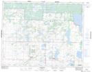
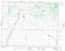
Maps showing Czwaluk Lake, 18-18-22-W, Manitoba
Czwaluk Lake is a Lake located in 18-18-22-W, Manitoba and has an elevation of 575 meters.
- Latitude: 50° 32' 38'' North (decimal: 50.5438999)
- Longitude: 100° 29' 59'' West (decimal: -100.4997000)
- Topography Feature Category: Lake
- Geographical Feature: Lake
- Canadian Province/Territory: Manitoba
- Elevation: 575 meters
- Location: 18-18-22-W
- Atlas of Canada Locator Map: Czwaluk Lake
- GPS Coordinate Locator Map: Czwaluk Lake Lat/Long
Czwaluk Lake NTS Map Sheets