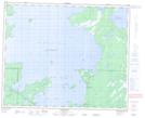
Maps showing Dawson Bay, 23-46-25-W1, Manitoba
Dawson Bay is a Unincorporated area located in 23-46-25-W1, Manitoba.
- Latitude: 52° 58' 36'' North (decimal: 52.9766999)
- Longitude: 100° 58' 47'' West (decimal: -100.9797000)
- Topography Feature Category: Unincorporated area
- Geographical Feature: Northern Community
- Canadian Province/Territory: Manitoba
- Location: 23-46-25-W1
- Atlas of Canada Locator Map: Dawson Bay
- GPS Coordinate Locator Map: Dawson Bay Lat/Long
Dawson Bay NTS Map Sheets