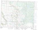
Maps showing Deering Lakes, 13,14-29-27-W, Manitoba
Deering Lakes is a Lake located in 13,14-29-27-W, Manitoba and has an elevation of 669 meters.
- Latitude: 51° 29' 10'' North (decimal: 51.4860999)
- Longitude: 101° 8' 35'' West (decimal: -101.1431000)
- Topography Feature Category: Lake
- Geographical Feature: Lakes
- Canadian Province/Territory: Manitoba
- Elevation: 669 meters
- Location: 13,14-29-27-W
- Atlas of Canada Locator Map: Deering Lakes
- GPS Coordinate Locator Map: Deering Lakes Lat/Long
Deering Lakes NTS Map Sheets