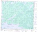
Maps showing Dering, 9,10-61-21-W, Manitoba
Dering is a Unincorporated area located in 9,10-61-21-W, Manitoba and has an elevation of 272 meters.
- Latitude: 54° 15' 15'' North (decimal: 54.2542000)
- Longitude: 100° 32' 00'' West (decimal: -100.5333000)
- Topography Feature Category: Unincorporated area
- Geographical Feature: Railway Point
- Canadian Province/Territory: Manitoba
- Elevation: 272 meters
- Location: 9,10-61-21-W
- Atlas of Canada Locator Map: Dering
- GPS Coordinate Locator Map: Dering Lat/Long
Dering NTS Map Sheets