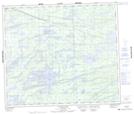
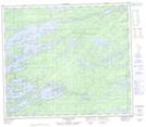
Maps showing Devil Brook, 71-2-E, Manitoba
Devil Brook is a River located in 71-2-E, Manitoba and has an elevation of 203 meters.
- Latitude: 55° 10' 51'' North (decimal: 55.1808000)
- Longitude: 97° 14' 49'' West (decimal: -97.2469000)
- Topography Feature Category: River
- Geographical Feature: Brook
- Canadian Province/Territory: Manitoba
- Elevation: 203 meters
- Location: 71-2-E
- Atlas of Canada Locator Map: Devil Brook
- GPS Coordinate Locator Map: Devil Brook Lat/Long
Devil Brook NTS Map Sheets