Canada Topographic Maps

Devil Rapids Topo Maps

Topography maps and Latitude/Longitude Location

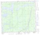
Maps showing Devil Rapids, Manitoba

Devil Rapids is a Rapids located in Manitoba.

  • Latitude: 55° 48' North   (decimal: 55.8000000)
  • Longitude: 96° 36' West   (decimal: -96.6000000)
  • Topography Feature Category: Rapids
  • Geographical Feature: Rapids
  • Canadian Province/Territory: Manitoba
  • GPS Coordinate Locator Map: Devil Rapids Lat/Long

Devil Rapids NTS Map Sheets

063P15 Arnot Topographic Map at 1:50,000 scale

063P Sipiwesk Topographic Map at 1:250,000 scale

 
Buy Topographic Maps DVD
Newsletter Sign-up

Yes, I want to receive map store discounts.


Bookmark and Share