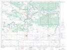
Maps showing Devils Punch Bowl, 9,16-8-14-W1, Manitoba
Devils Punch Bowl is a Valley located in 9,16-8-14-W1, Manitoba and has an elevation of 344 meters.
- Latitude: 49° 39' 4'' North (decimal: 49.6510999)
- Longitude: 99° 18' 11'' West (decimal: -99.3031000)
- Topography Feature Category: Valley
- Geographical Feature: Ravine
- Canadian Province/Territory: Manitoba
- Elevation: 344 meters
- Location: 9,16-8-14-W1
- Atlas of Canada Locator Map: Devils Punch Bowl
- GPS Coordinate Locator Map: Devils Punch Bowl Lat/Long