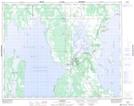
Maps showing Dillaboughs Point, Manitoba
Dillaboughs Point is a Cape located in Manitoba and has an elevation of 251 meters.
- Latitude: 51° 32' 6'' North (decimal: 51.5350000)
- Longitude: 98° 32' 26'' West (decimal: -98.5405999)
- Topography Feature Category: Cape
- Geographical Feature: Point
- Canadian Province/Territory: Manitoba
- Elevation: 251 meters
- Atlas of Canada Locator Map: Dillaboughs Point
- GPS Coordinate Locator Map: Dillaboughs Point Lat/Long
Dillaboughs Point NTS Map Sheets