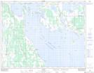
Maps showing Dog Lake Drain, Manitoba
Dog Lake Drain is a Hydraulic construction located in Manitoba and has an elevation of 249 meters.
- Latitude: 50° 56' 54'' North (decimal: 50.9482999)
- Longitude: 98° 38' 10'' West (decimal: -98.6360999)
- Topography Feature Category: Hydraulic construction
- Geographical Feature: Drain
- Canadian Province/Territory: Manitoba
- Elevation: 249 meters
- Atlas of Canada Locator Map: Dog Lake Drain
- GPS Coordinate Locator Map: Dog Lake Drain Lat/Long