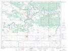
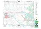
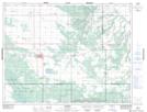
Maps showing Douglas Marsh, 9,10-15,16,17-W, Manitoba
Douglas Marsh is a Low vegetation located in 9,10-15,16,17-W, Manitoba and has an elevation of 358 meters.
- Latitude: 49° 49' 30'' North (decimal: 49.8249999)
- Longitude: 99° 30' 15'' West (decimal: -99.5042000)
- Topography Feature Category: Low vegetation
- Geographical Feature: Marsh
- Canadian Province/Territory: Manitoba
- Elevation: 358 meters
- Location: 9,10-15,16,17-W
- Atlas of Canada Locator Map: Douglas Marsh
- GPS Coordinate Locator Map: Douglas Marsh Lat/Long
Douglas Marsh NTS Map Sheets