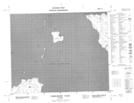
Maps showing Dowling Reef, Manitoba
Dowling Reef is a Shoal located in Manitoba.
- Latitude: 52° 0' 52'' North (decimal: 52.0143999)
- Longitude: 97° 7' 22'' West (decimal: -97.1227999)
- Topography Feature Category: Shoal
- Geographical Feature: Reef
- Canadian Province/Territory: Manitoba
- Atlas of Canada Locator Map: Dowling Reef
- GPS Coordinate Locator Map: Dowling Reef Lat/Long
Dowling Reef NTS Map Sheets