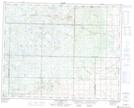
Maps showing Drifting River, 30-27-22-W, Manitoba
Drifting River is a Unincorporated area located in 30-27-22-W, Manitoba and has an elevation of 438 meters.
- Latitude: 51° 20' 1'' North (decimal: 51.3335999)
- Longitude: 100° 33' 19'' West (decimal: -100.5552999)
- Topography Feature Category: Unincorporated area
- Geographical Feature: Locality
- Canadian Province/Territory: Manitoba
- Elevation: 438 meters
- Location: 30-27-22-W
- Atlas of Canada Locator Map: Drifting River
- GPS Coordinate Locator Map: Drifting River Lat/Long
Drifting River NTS Map Sheets