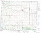
Maps showing Dry Creek, 26-25-23-W, Manitoba
Dry Creek is a River located in 26-25-23-W, Manitoba and has an elevation of 413 meters.
- Latitude: 51° 11' 56'' North (decimal: 51.1989000)
- Longitude: 100° 35' 45'' West (decimal: -100.5957999)
- Topography Feature Category: River
- Geographical Feature: Creek
- Canadian Province/Territory: Manitoba
- Elevation: 413 meters
- Location: 26-25-23-W
- Atlas of Canada Locator Map: Dry Creek
- GPS Coordinate Locator Map: Dry Creek Lat/Long
Dry Creek NTS Map Sheets