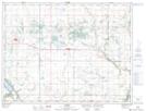
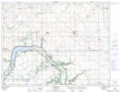
Maps showing Dry River, 24-4-12-W, Manitoba
Dry River is a River located in 24-4-12-W, Manitoba and has an elevation of 429 meters.
- Latitude: 49° 19' 27'' North (decimal: 49.3242000)
- Longitude: 98° 57' 48'' West (decimal: -98.9632999)
- Topography Feature Category: River
- Geographical Feature: River
- Canadian Province/Territory: Manitoba
- Elevation: 429 meters
- Location: 24-4-12-W
- Atlas of Canada Locator Map: Dry River
- GPS Coordinate Locator Map: Dry River Lat/Long
Dry River NTS Map Sheets