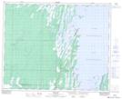
Maps showing Duck Bay, 17-37-19-W, Manitoba
Duck Bay is a Unincorporated area located in 17-37-19-W, Manitoba and has an elevation of 270 meters.
- Latitude: 52° 10' 35'' North (decimal: 52.1764000)
- Longitude: 100° 8' 57'' West (decimal: -100.1492000)
- Topography Feature Category: Unincorporated area
- Geographical Feature: Northern Community
- Canadian Province/Territory: Manitoba
- Elevation: 270 meters
- Location: 17-37-19-W
- Atlas of Canada Locator Map: Duck Bay
- GPS Coordinate Locator Map: Duck Bay Lat/Long