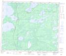
Maps showing Duckbill Lake, 62,63-25-W, Manitoba
Duckbill Lake is a Lake located in 62,63-25-W, Manitoba and has an elevation of 278 meters.
- Latitude: 54° 24' 54'' North (decimal: 54.4150000)
- Longitude: 101° 6' 25'' West (decimal: -101.1068999)
- Topography Feature Category: Lake
- Geographical Feature: Lake
- Canadian Province/Territory: Manitoba
- Elevation: 278 meters
- Location: 62,63-25-W
- Atlas of Canada Locator Map: Duckbill Lake
- GPS Coordinate Locator Map: Duckbill Lake Lat/Long
Duckbill Lake NTS Map Sheets