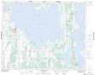
Maps showing Dufaults Point, 30-15-W, Manitoba
Dufaults Point is a Cape located in 30-15-W, Manitoba and has an elevation of 259 meters.
- Latitude: 51° 34' 27'' North (decimal: 51.5741999)
- Longitude: 99° 31' 9'' West (decimal: -99.5191999)
- Topography Feature Category: Cape
- Geographical Feature: Point
- Canadian Province/Territory: Manitoba
- Elevation: 259 meters
- Location: 30-15-W
- Atlas of Canada Locator Map: Dufaults Point
- GPS Coordinate Locator Map: Dufaults Point Lat/Long
Dufaults Point NTS Map Sheets