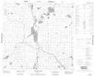
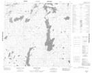
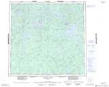
Maps showing Duke Creek, Manitoba
Duke Creek is a River located in Manitoba and has an elevation of 332 meters.
- Latitude: 58° 19' 13'' North (decimal: 58.3203000)
- Longitude: 99° 37' 52'' West (decimal: -99.6310999)
- Topography Feature Category: River
- Geographical Feature: Creek
- Canadian Province/Territory: Manitoba
- Elevation: 332 meters
- Atlas of Canada Locator Map: Duke Creek
- GPS Coordinate Locator Map: Duke Creek Lat/Long
Duke Creek NTS Map Sheets