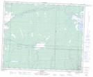
Maps showing Duncan Creek, 2-46-29-W, Manitoba
Duncan Creek is a River located in 2-46-29-W, Manitoba.
- Latitude: 52° 56' 20'' North (decimal: 52.9388999)
- Longitude: 101° 33' 44'' West (decimal: -101.5622000)
- Topography Feature Category: River
- Geographical Feature: Creek
- Canadian Province/Territory: Manitoba
- Location: 2-46-29-W
- Atlas of Canada Locator Map: Duncan Creek
- GPS Coordinate Locator Map: Duncan Creek Lat/Long