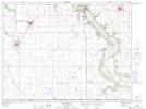
Maps showing Eagle Hill, 15-2-9-W, Manitoba
Eagle Hill is a Mountain located in 15-2-9-W, Manitoba and has an elevation of 433 meters.
- Latitude: 49° 7' 52'' North (decimal: 49.1311000)
- Longitude: 98° 35' 55'' West (decimal: -98.5985999)
- Topography Feature Category: Mountain
- Geographical Feature: Hill
- Canadian Province/Territory: Manitoba
- Elevation: 433 meters
- Location: 15-2-9-W
- Atlas of Canada Locator Map: Eagle Hill
- GPS Coordinate Locator Map: Eagle Hill Lat/Long
Eagle Hill NTS Map Sheets