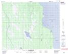
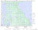
Maps showing Eaglenest Island, 29-36-5-W, Manitoba
Eaglenest Island is a Island located in 29-36-5-W, Manitoba and has an elevation of 216 meters.
- Latitude: 52° 7' 38'' North (decimal: 52.1272000)
- Longitude: 98° 8' 15'' West (decimal: -98.1375000)
- Topography Feature Category: Island
- Geographical Feature: Island
- Canadian Province/Territory: Manitoba
- Elevation: 216 meters
- Location: 29-36-5-W
- Atlas of Canada Locator Map: Eaglenest Island
- GPS Coordinate Locator Map: Eaglenest Island Lat/Long
Eaglenest Island NTS Map Sheets