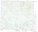
Maps showing East Camp Lake, 35,36-70-20-W, Manitoba
East Camp Lake is a Lake located in 35,36-70-20-W, Manitoba and has an elevation of 331 meters.
- Latitude: 55° 6' 13'' North (decimal: 55.1036000)
- Longitude: 100° 22' 59'' West (decimal: -100.3831000)
- Topography Feature Category: Lake
- Geographical Feature: Lake
- Canadian Province/Territory: Manitoba
- Elevation: 331 meters
- Location: 35,36-70-20-W
- Atlas of Canada Locator Map: East Camp Lake
- GPS Coordinate Locator Map: East Camp Lake Lat/Long
East Camp Lake NTS Map Sheets