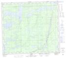
Maps showing Easter Lake, 78-4-E, Manitoba
Easter Lake is a Lake located in 78-4-E, Manitoba and has an elevation of 185 meters.
- Latitude: 55° 47' 7'' North (decimal: 55.7852999)
- Longitude: 96° 51' 53'' West (decimal: -96.8646999)
- Topography Feature Category: Lake
- Geographical Feature: Lake
- Canadian Province/Territory: Manitoba
- Elevation: 185 meters
- Location: 78-4-E
- Atlas of Canada Locator Map: Easter Lake
- GPS Coordinate Locator Map: Easter Lake Lat/Long