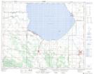
Maps showing Edwards Creek Drain, 7-25-17-W, Manitoba
Edwards Creek Drain is a Hydraulic construction located in 7-25-17-W, Manitoba and has an elevation of 272 meters.
- Latitude: 51° 9' 10'' North (decimal: 51.1528000)
- Longitude: 99° 50' 43'' West (decimal: -99.8452999)
- Topography Feature Category: Hydraulic construction
- Geographical Feature: Ditch
- Canadian Province/Territory: Manitoba
- Elevation: 272 meters
- Location: 7-25-17-W
- Atlas of Canada Locator Map: Edwards Creek Drain
- GPS Coordinate Locator Map: Edwards Creek Drain Lat/Long
Edwards Creek Drain NTS Map Sheets