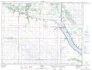
Maps showing The Elbow, 4,9-6-18-W, Manitoba
The Elbow is a River feature located in 4,9-6-18-W, Manitoba and has an elevation of 391 meters.
- Latitude: 49° 27' 41'' North (decimal: 49.4614000)
- Longitude: 99° 50' 48'' West (decimal: -99.8466999)
- Topography Feature Category: River feature
- Geographical Feature: Bend
- Canadian Province/Territory: Manitoba
- Elevation: 391 meters
- Location: 4,9-6-18-W
- Atlas of Canada Locator Map: The Elbow
- GPS Coordinate Locator Map: The Elbow Lat/Long