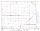
Maps showing 11-A Drain, 36-7-2-W, Manitoba
11-A Drain is a Hydraulic construction located in 36-7-2-W, Manitoba and has an elevation of 254 meters.
- Latitude: 49° 37' 14'' North (decimal: 49.6205999)
- Longitude: 97° 35' 41'' West (decimal: -97.5947000)
- Topography Feature Category: Hydraulic construction
- Geographical Feature: Drain
- Canadian Province/Territory: Manitoba
- Elevation: 254 meters
- Location: 36-7-2-W
- Atlas of Canada Locator Map: 11-A Drain
- GPS Coordinate Locator Map: 11-A Drain Lat/Long