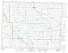
Maps showing Elkhorn, 11,12-28-W, Manitoba
Elkhorn is a Village located in 11,12-28-W, Manitoba and has an elevation of 499 meters.
- Latitude: 49° 58' 32'' North (decimal: 49.9756000)
- Longitude: 101° 14' 22'' West (decimal: -101.2394000)
- Topography Feature Category: Village
- Geographical Feature: Village
- Canadian Province/Territory: Manitoba
- Elevation: 499 meters
- Location: 11,12-28-W
- Atlas of Canada Locator Map: Elkhorn
- GPS Coordinate Locator Map: Elkhorn Lat/Long