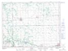
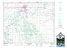
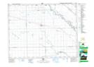
Maps showing Elm Creek Channel, 32-9-2-W, Manitoba
Elm Creek Channel is a River located in 32-9-2-W, Manitoba and has an elevation of 271 meters.
- Latitude: 49° 47' 47'' North (decimal: 49.7964000)
- Longitude: 97° 41' 26'' West (decimal: -97.6905999)
- Topography Feature Category: River
- Geographical Feature: Channel
- Canadian Province/Territory: Manitoba
- Elevation: 271 meters
- Location: 32-9-2-W
- Atlas of Canada Locator Map: Elm Creek Channel
- GPS Coordinate Locator Map: Elm Creek Channel Lat/Long
Elm Creek Channel NTS Map Sheets