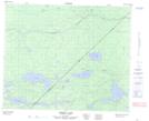
Maps showing Fairy Woman Creek, Manitoba
Fairy Woman Creek is a River located in Manitoba.
- Latitude: 53° 13' 5'' North (decimal: 53.2180999)
- Longitude: 94° 41' 21'' West (decimal: -94.6891999)
- Topography Feature Category: River
- Geographical Feature: Creek
- Canadian Province/Territory: Manitoba
- Atlas of Canada Locator Map: Fairy Woman Creek
- GPS Coordinate Locator Map: Fairy Woman Creek Lat/Long
Fairy Woman Creek NTS Map Sheets