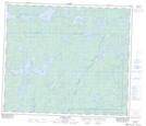
Maps showing Fay Creek, 69-26-W, Manitoba
Fay Creek is a River located in 69-26-W, Manitoba and has an elevation of 332 meters.
- Latitude: 54° 58' 42'' North (decimal: 54.9783000)
- Longitude: 101° 17' 30'' West (decimal: -101.2917000)
- Topography Feature Category: River
- Geographical Feature: Creek
- Canadian Province/Territory: Manitoba
- Elevation: 332 meters
- Location: 69-26-W
- Atlas of Canada Locator Map: Fay Creek
- GPS Coordinate Locator Map: Fay Creek Lat/Long
Fay Creek NTS Map Sheets