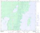
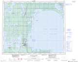
Maps showing Fiddler Point, 15-51-12-W, Manitoba
Fiddler Point is a Cape located in 15-51-12-W, Manitoba and has an elevation of 216 meters.
- Latitude: 53° 24' 28'' North (decimal: 53.4078000)
- Longitude: 99° 7' 53'' West (decimal: -99.1314000)
- Topography Feature Category: Cape
- Geographical Feature: Point
- Canadian Province/Territory: Manitoba
- Elevation: 216 meters
- Location: 15-51-12-W
- Atlas of Canada Locator Map: Fiddler Point
- GPS Coordinate Locator Map: Fiddler Point Lat/Long
Fiddler Point NTS Map Sheets