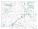
Maps showing Five Mile Creek, 19-8-16-W, Manitoba
Five Mile Creek is a River located in 19-8-16-W, Manitoba and has an elevation of 397 meters.
- Latitude: 49° 40' 27'' North (decimal: 49.6742000)
- Longitude: 99° 37' 44'' West (decimal: -99.6288999)
- Topography Feature Category: River
- Geographical Feature: Creek
- Canadian Province/Territory: Manitoba
- Elevation: 397 meters
- Location: 19-8-16-W
- Atlas of Canada Locator Map: Five Mile Creek
- GPS Coordinate Locator Map: Five Mile Creek Lat/Long