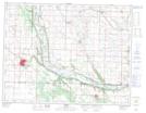
Maps showing Flat Creek, 36-9-24-W, Manitoba
Flat Creek is a River located in 36-9-24-W, Manitoba and has an elevation of 396 meters.
- Latitude: 49° 47' 14'' North (decimal: 49.7871999)
- Longitude: 100° 36' 3'' West (decimal: -100.6007999)
- Topography Feature Category: River
- Geographical Feature: Creek
- Canadian Province/Territory: Manitoba
- Elevation: 396 meters
- Location: 36-9-24-W
- Atlas of Canada Locator Map: Flat Creek
- GPS Coordinate Locator Map: Flat Creek Lat/Long