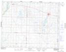
Maps showing Fleming Marsh, 27,28-16-24-W, Manitoba
Fleming Marsh is a Low vegetation located in 27,28-16-24-W, Manitoba and has an elevation of 549 meters.
- Latitude: 50° 23' 25'' North (decimal: 50.3902999)
- Longitude: 100° 42' 39'' West (decimal: -100.7107999)
- Topography Feature Category: Low vegetation
- Geographical Feature: Marsh
- Canadian Province/Territory: Manitoba
- Elevation: 549 meters
- Location: 27,28-16-24-W
- Atlas of Canada Locator Map: Fleming Marsh
- GPS Coordinate Locator Map: Fleming Marsh Lat/Long
Fleming Marsh NTS Map Sheets