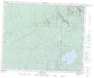
Maps showing Float Island Lake, 41-29-W, Manitoba
Float Island Lake is a Lake located in 41-29-W, Manitoba and has an elevation of 724 meters.
- Latitude: 52° 31' 18'' North (decimal: 52.5216999)
- Longitude: 101° 36' 40'' West (decimal: -101.6110999)
- Topography Feature Category: Lake
- Geographical Feature: Lake
- Canadian Province/Territory: Manitoba
- Elevation: 724 meters
- Location: 41-29-W
- Atlas of Canada Locator Map: Float Island Lake
- GPS Coordinate Locator Map: Float Island Lake Lat/Long
Float Island Lake NTS Map Sheets