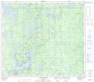
Maps showing Footprint Lake, 78,79-9,10-W, Manitoba
Footprint Lake is a Lake located in 78,79-9,10-W, Manitoba and has an elevation of 238 meters.
- Latitude: 55° 47' 3'' North (decimal: 55.7841999)
- Longitude: 98° 52' 37'' West (decimal: -98.8769000)
- Topography Feature Category: Lake
- Geographical Feature: Lake
- Canadian Province/Territory: Manitoba
- Elevation: 238 meters
- Location: 78,79-9,10-W
- Atlas of Canada Locator Map: Footprint Lake
- GPS Coordinate Locator Map: Footprint Lake Lat/Long
Footprint Lake NTS Map Sheets