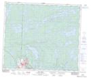
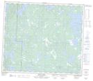
Maps showing Forester Lake, 69-29-W, Manitoba
Forester Lake is a Lake located in 69-29-W, Manitoba and has an elevation of 334 meters.
- Latitude: 55° 0' 11'' North (decimal: 55.0030999)
- Longitude: 101° 48' 46'' West (decimal: -101.8127999)
- Topography Feature Category: Lake
- Geographical Feature: Lake
- Canadian Province/Territory: Manitoba
- Elevation: 334 meters
- Location: 69-29-W
- Atlas of Canada Locator Map: Forester Lake
- GPS Coordinate Locator Map: Forester Lake Lat/Long
Forester Lake NTS Map Sheets