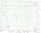
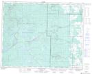
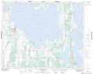
Maps showing Fork River, 25-29-19-W, Manitoba
Fork River is a River located in 25-29-19-W, Manitoba and has an elevation of 261 meters.
- Latitude: 51° 30' 45'' North (decimal: 51.5124999)
- Longitude: 100° 0' 55'' West (decimal: -100.0152999)
- Topography Feature Category: River
- Geographical Feature: River
- Canadian Province/Territory: Manitoba
- Elevation: 261 meters
- Location: 25-29-19-W
- Atlas of Canada Locator Map: Fork River
- GPS Coordinate Locator Map: Fork River Lat/Long
Fork River NTS Map Sheets