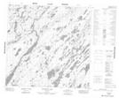
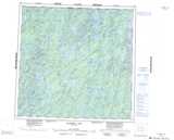
Maps showing Fort Hall, Manitoba
Fort Hall is a Unincorporated area located in Manitoba.
- Latitude: 59° 23' 43'' North (decimal: 59.3953000)
- Longitude: 101° 19' 10'' West (decimal: -101.3194000)
- Topography Feature Category: Unincorporated area
- Geographical Feature: Locality
- Canadian Province/Territory: Manitoba
- Atlas of Canada Locator Map: Fort Hall
- GPS Coordinate Locator Map: Fort Hall Lat/Long
Fort Hall NTS Map Sheets