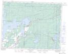
Maps showing Fournier Island, 7,8-16-15-E, Manitoba
Fournier Island is a Island located in 7,8-16-15-E, Manitoba and has an elevation of 284 meters.
- Latitude: 50° 19' 45'' North (decimal: 50.3291999)
- Longitude: 95° 30' 56'' West (decimal: -95.5155999)
- Topography Feature Category: Island
- Geographical Feature: Island
- Canadian Province/Territory: Manitoba
- Elevation: 284 meters
- Location: 7,8-16-15-E
- Atlas of Canada Locator Map: Fournier Island
- GPS Coordinate Locator Map: Fournier Island Lat/Long
Fournier Island NTS Map Sheets