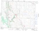
Maps showing Foxwarren, 4-18-27-W, Manitoba
Foxwarren is a Unincorporated area located in 4-18-27-W, Manitoba and has an elevation of 527 meters.
- Latitude: 50° 31' 2'' North (decimal: 50.5172000)
- Longitude: 101° 9' 5'' West (decimal: -101.1513999)
- Topography Feature Category: Unincorporated area
- Geographical Feature: Community
- Canadian Province/Territory: Manitoba
- Elevation: 527 meters
- Location: 4-18-27-W
- Atlas of Canada Locator Map: Foxwarren
- GPS Coordinate Locator Map: Foxwarren Lat/Long
Foxwarren NTS Map Sheets