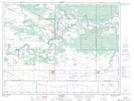
Maps showing Froebe Hill, 22-8-12-W, Manitoba
Froebe Hill is a Mountain located in 22-8-12-W, Manitoba and has an elevation of 361 meters.
- Latitude: 49° 40' 19'' North (decimal: 49.6719000)
- Longitude: 99° 0' 47'' West (decimal: -99.0130999)
- Topography Feature Category: Mountain
- Geographical Feature: Hill
- Canadian Province/Territory: Manitoba
- Elevation: 361 meters
- Location: 22-8-12-W
- Atlas of Canada Locator Map: Froebe Hill
- GPS Coordinate Locator Map: Froebe Hill Lat/Long