Maps showing Gaddy Drain, 11-14-13-W, Manitoba
Gaddy Drain is a Hydraulic construction located in 11-14-13-W, Manitoba.
- Latitude: 50° 10' 39'' North (decimal: 50.1774999)
- Longitude: 99° 8' 43'' West (decimal: -99.1452999)
- Topography Feature Category: Hydraulic construction
- Geographical Feature: Drain
- Canadian Province/Territory: Manitoba
- Location: 11-14-13-W
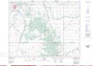
- Atlas of Canada Locator Map: Gaddy Drain
- GPS Coordinate Locator Map: Gaddy Drain Lat/Long